

Land use plan
Kings Bay owns the Kongsfjorden Property (treaty property 38/1) and is responsible for the Ny‐Ålesund planning area under Section 48 of the Svalbard Environmental Protection Act.
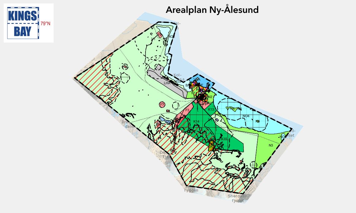
The land-use plan for Ny-Ålesund 2024-2034 was adopted by the Governor of Svalbard on 30. April 2024, cf. Section 52 of the Svalbard Environmental Protection Act.
The purpose of the land use plan is to prepare an appropriate and updated legal management tool for development, use and protection of areas and buildings in the Ny-Ålesund planning area.
The land-use plan Ny-Ålesund 2024-2034 consist of:
· Plan map with purpose-defined use and protection, dated 30. April 2024 link to plan access
· Supplementary provisions and guidelines, dated 30. April 2024
· Plan description, dated 30. April 2024
· Background documents
Please note that the Norwegian version of the planning documents is legally binding in case of doubt. The English version of the planning documents will be published soon.